Galaxy G5 (IMU)
Galaxy G5 (IMU)
RTK GNSS Receiver with Inertial Inclination Sensor (IMU)
136,694.00uah
Available
Galaxy G5 (IMU)

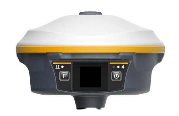
Galaxy G5 - a new RTK receiver with an Inertial Inclination Sensor (IMU) and a color touchscreen display.

Key features:

With 1760 channels, the G5 is able to track the signal from 5 groups of satellites, process the signal up to 16 frequencies and provide stable and reliable accuracy. The increased battery capacity and the developed power management system allows the G5 to work for 10 to 25 hours and can be charged using the Type-C connector.

When the G5 loses its fix from the base station, the RTK-Keep function can provide the receiver with a more accurate position for several minutes. The technology, based on the Farlink protocol, increases the sensitivity of reception and the efficiency of radio signal transmission, which allows the built-in radio channel to work at significant distances - up to 15 km. The built-in inertial unit (IMU) and the landmark tilt compensation algorithm in the range of up to 60° allow you to quickly achieve centimeter positioning accuracy. Voice messages (including in Russian) and a color display with a diagonal of 1.3 inches make the receiver more convenient and easy to use. The increased built-in memory of 16 GB and the cyclic memory release function help the receiver to automatically delete old files when memory is low.

GNSS Features
Channels
1760
GPS
L1C/A, L1C, L2C, L2P, L5
GLONASS
L1C/A, L2C/A, L2P, L3CDMA
BDS
B1I, B1C, B2I, B2a, B3
GALILEO
E1, E5A, E5B, E5AltBOC, E6
SBAS
EGNOS, WAAS, GAGAN, MSAS, SDCM(L1,L5)
QZSS
L1C/A, L1C, L2C, L5, L6
Navic
L5
Positioning output rate
1-50 Hz
Initialization time
< 10 s
Initialization reliability
>99.99%
Positioning Precision(RMC)
Standalone
H: 1.2 m, V: 1.9 m
DGNSS
H: 0.4 m + 1 ppm, V: 0.7 m + 1 ppm
Static
H: 2.5 mm + 0.5 ppm, V: 5 mm + 0.5 ppm
RTK (baseline<40km)
H: 6 mm + 0.5ppm, V: 10 mm + 1 ppm.
SBAS
H: 0.6 m, V: 0.8 m
RTK initialization time
2-8 s
IMU
IMU tilt compensation 30º
<10 mm + 0.7 mm/º
IMU tilt angle
0 ° ~ 60 °
Hardware Performance
Dimension
165 mm(diameter)×108mm(H)
Weight
1350g (battery included)
Material
Magnesium aluminum alloy shell
Operating temperature
-30℃ ~ +70℃
Humidity
100% Non-condensing
Waterproof/Dustproof
IP68
Shock/Vibration
Withstands a drop from a height of 2 meters onto concrete
Battery life
Built-in lithium-ion battery with a capacity of 10,000mAh
Time of continuous work
20-25 hours (static); 10-12 hours (base); 16-20 h (rover).
Communications
I/O Port
5-PIN LEMO external power port + RS232 Type-C(charge+USB+OTG+Ethernet) 1 UHF antenna interface
Internal UHF
3W transmission and reception of a radio signal
Frequency range
410-470MHz
Protocol support
Farlink, Trimtalk450s, SOUTH, HUACE, Hi-target, Satel
Communication range
up to 15 km using the Farlink protocol
Cellular
4G
Bluetooth
Bluetooth 4.2, 2.1+EDR
NFC Communication
Realizing close range (shorter than 10cm) automatic pair between receiver and controller
WIFI
Modem standard 802.11 b/g. WIFI access point to access the Web interface. Data transmission via WIFI (the receiver can transmit corrections via WIFI).
Storage
16GB SSD (expandable to 64 GB), in case of lack of memory, old data is automatically deleted to record new ones, supports external drives.
Data transfer
Plug and play mode of USB data transmission Supports FTP/HTTP data download
Data format
Static data format
STH, Rinex 2.x, Rinex 3.x.
Differential data format
CMR, RTCM 2.x, RTCM 3.x(MSM).
GPS out put data format
NMEA 0183, PJK plane coordinate, SBF.
NTRIP
fully supported
Sensors
Electronic bubble
Controller software can display electronic bubble, checking leveling status of the carbon pole in real-time
IMU
Built-in IMU module, calibration-free and immue to magnetic interference
Thermometer
Built-in thermometer sensor, adopting intelligent temperature control technology, monitoring and adjusting the receiver temperature
User Interaction
Operating system
Linux
Buttons
2
LED indicators
3
Touch screen
1.3-inch color
Web interaction
the web interface is accessed via WI-FI or USB
Є.П.С.South Surveying & Mapping InstrumentsCarlson Software, Inc.NovAtel Inc.SeptentrioCalianЄ.П.С.South Surveying & Mapping InstrumentsCarlson Software, Inc.NovAtel Inc.SeptentrioCalian