Powerful Novatel Grafnav/Grafnet software complex for processing static and kinematic GNSS (GPS+Glonass) measurements.
The current version is 8.30:
- full-fledged multi-base processing with simultaneous use of up to 8 base stations;
- new PPP module: post-session processing of GNSS measurements without using base station measurements;
- GrafNav: reliable algorithms after session processing of GNSS kinematic measurements carried out in the most difficult conditions;
- GrafNet: an efficient and easy-to-use package for processing static GNSS measurement sessions.
The complex runs on the Windows operating system and has a simple but at the same time convenient interface that allows for quick, accurate and reliable processing of "raw" satellite measurements. By simultaneously processing the measurements of the mobile (kinematic) receiver and the information of the base stations (up to 8), the package allows you to calculate the coordinates of points, trajectories and events during the observation session with high accuracy. The software complex supports data formats of "raw" measurements of most receivers present on the market (more than 40 types). It is possible to process both single-frequency (L1) and dual-frequency (L1/L2) measurements, as well as joint GPS+GLONASS data. The software has a modular structure, which allows the user not only to choose the optimal configuration at the time of purchasing the package, but also to carry out simple modernization of the program in the future.
GrafNav is a software package for multibase post-session processing of static and kinematic measurements performed in both code and phase modes. Depending on the method of conducting measurements, their quality and the selected processing mode, the accuracy of the results from subcentimeter to submeter is ensured. Although GrafNav is primarily focused on the processing of trajectory measurements, the package also performs multi-baseline processing of single static observation sessions.
Main features of GrafNav:
• True multi-base measurement processing. Measurements of one mobile receiver and up to eight (8!) base stations can be processed simultaneously;
• Support of "raw" measurements of most satellite receivers existing on the market;
• Ability to process single-frequency, dual-frequency and GPS+GLONASS measurements;
• KAR's unique own algorithm, which allows you to quickly and reliably resolve phase ambiguities in motion (the so-called OTF initialization), which works stably even at great distances of the mobile receiver from the base stations;
• Extensive options for setting processing parameters (more than 300);
• Ability to use accurate ephemeris, clock parameters and ionosphere models;
• Extremely fast processing processor;
• Direct, reverse and combined processing, which allows to increase the accuracy, as well as to identify problematic data segments faster;
• Saving processing options with the possibility of restoring any previous decision;
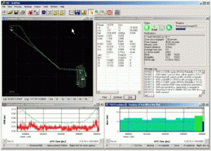
• Output of more than 30 graphs for visual and effective analysis of processing results;
• Import/export of event labels and polynomial interpolation of their coordinates;
• Built-in object editor, which allows you to manage and change information about epochs, events and stations throughout the measurement session;
• Support for most of the original geodetic datums (GDs), ellipsoids, map projections and the possibility of creating local user coordinate systems;
• Support for global, national and custom geoid models for accurate conversion to normal (orthometric) heights;
• Wide possibilities of creating own formats for export of results.
• The package includes a whole set of auxiliary utilities, including a module for scheduling observation sessions.
GrafNet is a software package developed for the Windows OS, specifically focused on post-session processing of measurements of static surveys, for example, when condensing networks or creating a reference base. The package also includes modules for calculating discontinuities on closed polygons, aligning networks, and transforming coordinates. In addition, GrafNet can be used for batch processing of a set of measurement sessions from one base station. Main features of GrafNet: • Support of most formats of "raw" measurements, including RINEX;
• Ability to display error ellipses for each station and vector;
• Extremely fast processing of measurements;
• Automatic forward/reverse processing;
• Processing of single-frequency, dual-frequency and GPS+GLONASS measurements;
• Support for processing long baselines and using accurate ephemerides;
• Possibility of automatic removal of dependent (trivial) vectors from the project;
• The possibility of automatic calculation of discontinuities on closed polygons;
• Built-in vector network alignment module with a weight strategy;
• Support for most of the original geodetic datums, ellipsoids, map projections and the possibility of creating local coordinate systems;
• Support for global, national and custom geoid models for accurate conversion to normal (orthometric) heights;
• Available graph output with comprehensive information for each baseline;
• Wide possibilities of creating own formats for export of results.


 Contact us