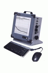
South SDE-28S+ - from the company South Surveying & Mapping Instruments - is a highly accurate and reliable tool for performing measured hydrographic works.
KEY FEATURES: Combining a computer and a high-precision measuring echo sounder in industrial production. Integrated Windows XP operating system, friendly software interface. Ergonomic design, all-aluminum body. High-speed processor for data processing. Full support for NMEA messages. High flexibility for connecting external GPS receivers Built-in flash memory. Large display (12.1 inches) with protection against direct sunlight. Automatic saving of depth data, the ability to reproduce measurements.
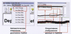
EMBEDDED SOFTWARE SDE-28S: for measuring depths Bright display of graphic and digital data about the underwater environment. Integrated sound speed calculation for more accurate results. Intelligent alarm output for shallow water and lack of response (echo) from the bottom to ensure the safety of hydrographic surveying. Operational display of depth values in the form of a track. Automatic measurements, intelligent and simple operation.


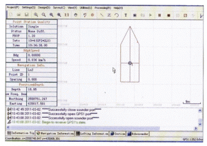
PowerNav: For navigation purposes
Increased speed and stability of parameter processing.
Professional map support and data management capability, the easiest way to set parameters.
High compatibility, the ability to import graphic and digital data, the ability to connect various GPS receivers and echo sounders.
Modular structure - ideal for various hydrographic survey projects.

Brief specification:
Areas of practical application:
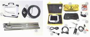
COMPLETENESS:

Warranty: 24 months.
 Contact us