Galaxy G9, IMU
Galaxy G9, IMU
RTK GNSS receiver with an inertial tilt sensor (IMU)
On request
Available
Galaxy G9, IMU

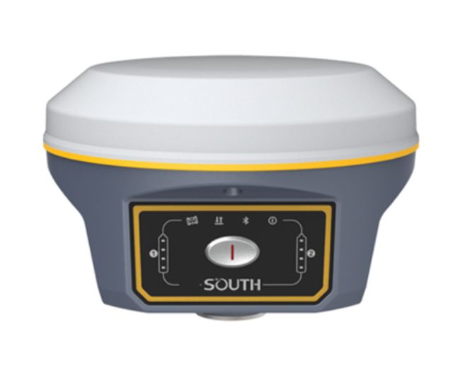
The Galaxy G9 received a new processor that is not only energy efficient, but also copes well with interference, thanks to which it receives high-quality data from all constellations of satellites, including BeiDou III. Thanks to the innovative design and the latest technologies of the SOUTH company, work with VHF has become even more reliable. The built-in radio module of the new generation supports all modern radio protocols, operates at a frequency of 410-470 MHz, and the radius of operation is increased to 10 km thanks to the Farlink protocol. The Galaxy G9 comes with a new generation inertial system, which will make measurements at an angle more accurate. The coordinates will be automatically corrected for the angle and direction of the milestone. Thanks to this technology, the need to set a milestone by level disappears, and productivity increases by 30%.

GNSS Features
Channels
1760
GPS
L1C/A , L1C , L2C , L2P , L5
GLONASS
L1C/A, L2C/A, L2P, L3CDMA
BDS
B1I, B1C, B2I, B2a, B3
GALILEO
E1, E5A, E5B, E5AltBOC, E6
SBAS
EGNOS, WAAS, GAGAN, MSAS, SDCM(L1,L5).
QZSS
L1C/A, L1C, L2C, L5, L6.
IRNSS
L5
Initialization time
< 10 s.
Positioning output rate
1-50Hz.
Positioning Precision
DGNSS
H: 0.4 m + 1 ppm, V: 0.7 m + 1 ppm(RMC).
Statik
H: 2.5 mm + 0.5 ppm, V: 5 mm + 0.5 ppm(RMC).
RTK (baseline <40кm)
H: 6 mm + 0.5 ppm, V: 10 mm + 1 ppm(RMC).
SBAS
H: 0.6 m, V: 0.8 m (RMC).
RTK initialization time
2-8 s
IMU tilt compensation
Additional horizontal pole tip uncertainty typically less than 10 mm + 0.7 mm/° tilt down to 30º.
IMU tilt angle
0°-60°.
Physical characteristics
Dimension
154 mm (diameter) , 106 mm (H).
Weight
1300 г (with battery)
Material
Aluminum-magnesium alloy body.
Working temperature
-25℃~+65℃.
Waterprof/Dustprof
IP68 standard, immersion to a depth of 1 meter, completely protected from dust.
Shock/Vibration
Withstands a drop from a height of 2 meters onto a concrete floor.
Battery life(Dual-battery)
15 y (rover Bluetooth mode)
Battery
7.4V 3400mAh x 2 Li-ion batteries.
Communications
I/O Port
5PIN LEMO external power port + Rs232, 7PIN LEMO (USB + OTG + Ethernet), 1 PPS port for VHF antenna
Internal UHF
1/2/3W radio signal transmission and reception
Frequency range
410-470МHz.
Protocol
Farlink, Trimtalk450s, SOUTH, HUACE, Hi-target, ZHD
Cellular mobile network
4G network communication module
Bluetooth
Bluetooth 3.0/4.1, 2.1+EDR
NFC
to connect the controller to the receiver.
WIFI
Modem
802.11 b/g
WIFI hotpost
The receiver broadcasts the access point from a web interface accessible from any mobile terminals
WIFI datalink
The receiver can transmit and receive a stream of corrections via Wi-Fi.
Data Storage/Transmission
Storage
Internal memory 16GB SSD, in case of lack of memory, old data is automatically deleted to record new ones, supports external drives
Data transmission
USB, FTP/HTTP
Data format
Output data format: NMEA 0183, PJK plane coordinate, SBF. Network support: VRS, FKP, MAC, full NTRIP protocol support.
Sensors
Electronic bubble
The controller software can display an electronic level, which can be used to determine the slope of the milestone in real time.
IMU
Built-in Inertial Unit (IMU), requires no calibration and is immune to magnetic interference
Thermometer
Built-in temperature sensor, intelligent temperature control technology
User Interaction
Operating System
Linux
Buttons
Single button
Indicators
4 color LED indicators , Battery indicator
Web UI
Wi-Fi or USB connection, users can monitor the status of the receiver and freely change its configuration.
Voice support
Voice message technology reproduces information about the status of the receiver, supports English, Russian and other languages